Map 01
Data-Center Policy and Public Pushback
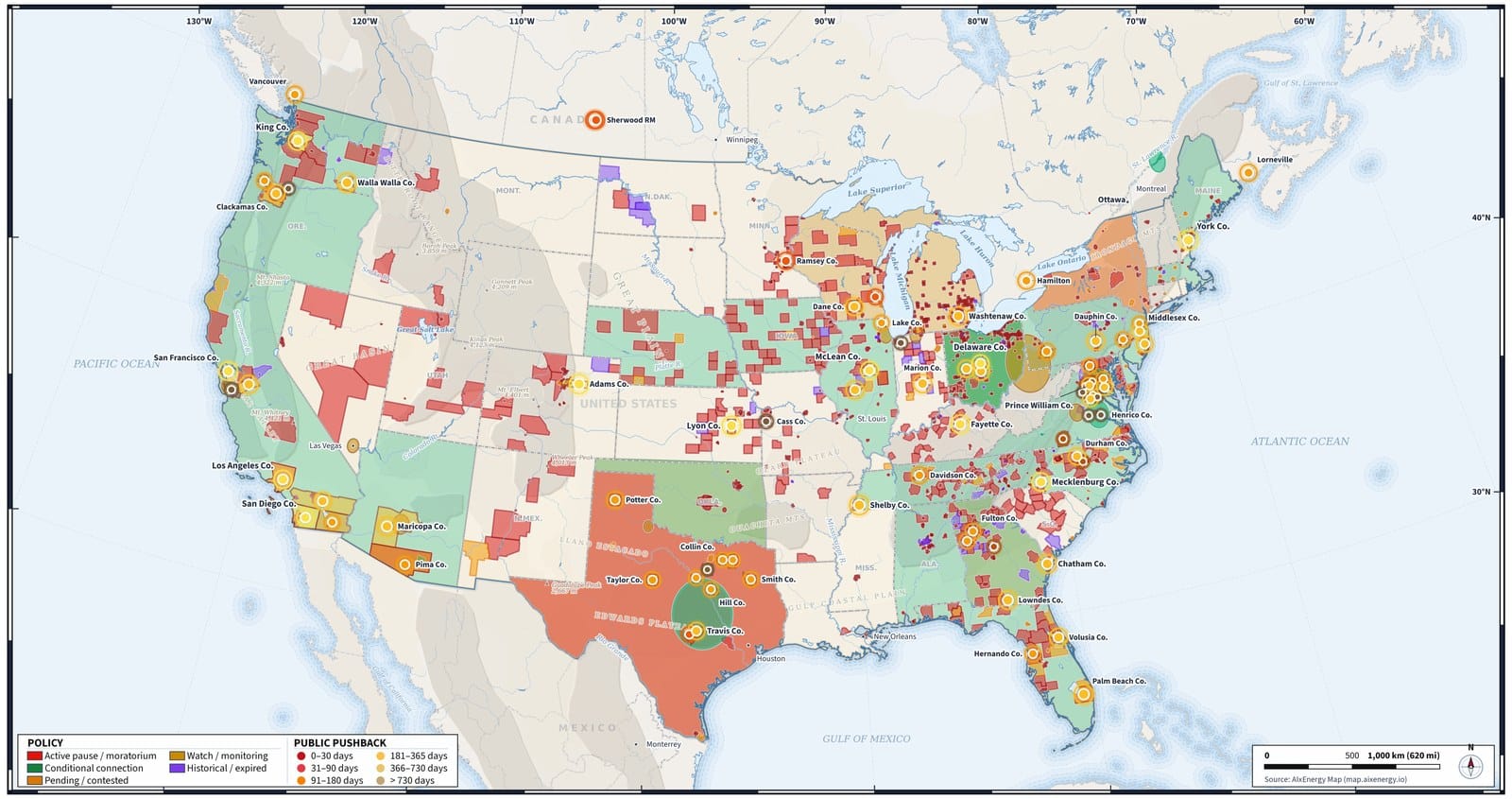
County and state policy actions on data centers across the United States and parts of Canada, colored by whether a pause or moratorium is active, conditional, pending, being watched, or already expired. Dots mark public pushback by how recently it was recorded.
Map 02
Data Centers and Nuclear Power
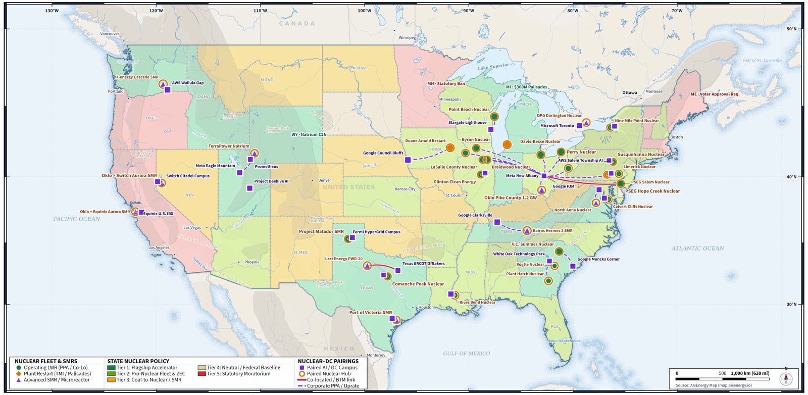
U.S. states colored by nuclear policy, from flagship accelerator programs to statutory moratoriums, with operating plants, restarts, and advanced SMRs. Markers and lines show pairings between data-center campuses and nuclear sites, including co-located and behind-the-meter links, corporate PPAs, and uprates.
Map 03
Data Centers and Geothermal Power
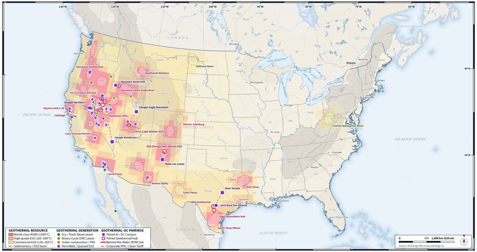
Geothermal resources and plants in the United States, with the strongest grades concentrated in the West, shaded from world-class known geothermal resource areas to commercial and sedimentary EGS. Markers show generating plants and the data-center campuses paired with them, including behind-the-meter links and corporate power agreements.
No maps match.